Project
Stephenson Avenue Extension New road project
![]() Stirling, Innaloo, Osborne Park
Stirling, Innaloo, Osborne Park


Overview
-

Road
Project type -

$461.4 million
Total budget
-

Under Construction
Project phase -

Main Roads WA
Lead agency
-

800
Jobs supported -

Late 2020
Start dateMid 2026
End date
The Stephenson Avenue Extension will provide a new connection from Cedric Street to Scarborough Beach Road, including an interchange at Mitchell Freeway.
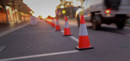
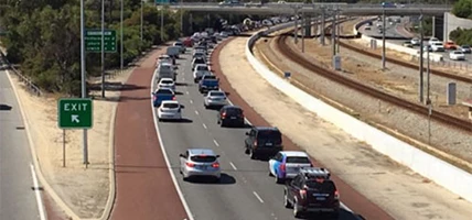
Road users are being urged to plan their journeys, with recent traffic changes in Innaloo and Stirling as a result of the Stephenson Avenue bridge being opened to traffic in December 2025.
Phase one was delivered by the City of Stirling and opened in February 2022. This included the extension of Scarborough Beach Road to Flax Way, new local road connections and improved shared paths.
Phase two involves extending Stephenson Avenue to Mitchell Freeway and Cedric Street, major upgrades to active transport links, with new shared paths and local road connections opening in stages, and a new Principal Shared Path (PSP).
The Stirling Bus Interchange will be delivered as part of this project, with completion anticipated in mid-2026. Works are underway to increase capacity from a 16-stand to a 29-stand facility, with a new pedestrian access between Stirling Station and the southern car park. Main Roads WA are delivering this upgrade on behalf of the Public Transport Authority.
For detailed project information, visit Main Roads WA.


Benefits
-
 A new traffic signalised intersection at Scarborough Beach Road.
 -
Ease traffic congestion and reduced traffic times.
-
Provision of a safe route for people riding and walking in the area.
-
Improve accessibility to the Stirling City Centre.
-
New shared paths along Stephenson Avenue.
-
Improved streetscaping in the area.
Gallery
-
Artwork under Stephenson Avenue by WA artists David Ledger and Joanne Clark. Inspired by Stirling’s market garden heritage.
-
The new Mitchell Freeway PSP connection between Civic Place and Telford Crescent is now opened.
-
The new bridge and east-west connection transforming journeys between Innaloo, Stirling and Osborne Park.
-
Video: Reshaping WA Report (Oct 2025). The Stephenson Avenue Extension is making good progress.
-
Progress on the new Stirling Bus Interchange.
-
Video: Pedestrian bridge installation.
-
The first artwork on the project features designs by Noongar artists David Jones and Kamsani Bin Salleh.
-
A new southbound on-ramp to the Mitchell Freeway is now open.
-
Stephenson Avenue Interchange Bridge now spanning across Mitchell Freeway.
-
The Stephenson Avenue Interchange Bridge and Stirling Station Bus Interchange Bridge is being incrementally ‘launched’ (pushed out) over the Mitchell Freeway.
-
The Stephenson Avenue Extension is now over 40 per cent complete.
-
Video: Learn more about the Stephenson Avenue Extension Project.
-
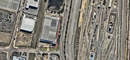
Aerial view of the Stephenson Avenue Extension.
-
View of early works on the project.
-
Stephenson Avenue Extension - Scarborough Beach Road to Sarich Court.


Project map
Detour options
-
Stirling Station - Southern Car Park Disruptions - From Thurs 10 Oct 2024
A section of the Stirling Station southern car park and the motorbike shelter will be closed from Thursday 10 October 2024 to commence the car park upgrade. ACROD, drop off/pick up bays and short term parking will be relocated to the eastern section of the car park. Alternative parking available, follow traffic signage. See Main Roads Travel Map for the most up-to-date information.
-
Cedric Street Southbound Off-Ramp Permanently Closed - From Fri 14 Nov 2025
The temporary Cedric Street southbound off-ramp from Mitchell Freeway has permanently closed to enable construction of the new southbound off-ramp to continue safely. Access to Innaloo, Stirling and surrounding areas will temporarily be via the following alternative routes until the new Stephenson Avenue southbound off-ramp is operational.
- To access Innaloo and northern Stirling - exit earlier at the Karrinyup Road southbound off-ramp.
- To access Osborne Park and southern Stirling - exit later at the Hutton Street southbound off-ramp.
See Main Roads Travel Map for the most up-to-date information.
-
Stirling Station - Southern Car Park Access - Dec 25 to Mid 2026
A section of the southern car park has reopened with access via the new Stephenson Avenue. Please follow signage in the area and exercise caution when accessing the car parks at Stirling Station. Pedestrian access from the Northern and temporary car parks have changed due to the Cedric Street westbound closure between Stephenson Avenue and Ellen Stirling Boulevard. See road and pedestrian detour map below. Visit Main Roads and the Travel Map for the most up-to-date information.

Plan your journey
Avoid disruptions to your journey and plan your trip