• The Armadale Line Transformation is underway. Find out more.

  • Learn more about the Smart Freeway Mitchell southbound here.

Project

Smart Freeway - Southbound Mitchell southbound

Clarkson, Craigie, Currambine, Duncraig, Innaloo, Gwelup, Joondalup, Kinross, Leederville, Osborne Park

Overview

  • Road

    Project type
  • $209.6 million

    Total budget
  • Under Construction

    Project phase
  • Main Roads WA

    Lead agency
  • 700

    Jobs supported
  • Mid 2021

    Start date

    Late 2024

    End date

Perth's newest smart freeway will be formally switched on, on Sunday, 22 December, providing commuters with faster and safer journeys.

More than 1,400 pieces of smart technology are being installed along the Mitchell Freeway southbound. Key features include overhead electronic signs and message boards, and coordinated ramp signals. The technology includes sensors and cameras to monitor traffic in real time 24/7.

Smart Freeways will provide motorists with greater journey reliability and improved safety by alleviating congestion at peak times and minimising stop-start conditions at merge points. 

The technology has already had great success along the Kwinana Freeway northbound, with motorists continuing to experience a safer journey and saving up to 6 minutes on their journeys between Farrington Road and the Narrows Bridge during the morning commute.

This project links to the Stephenson Avenue Extension project, which provides a new connection from Cedric Street to Scarborough Beach Road. An interchange will be introduced at Mitchell Freeway with a southbound Smart Freeway on-ramp, as well as new local road links to Ellen Stirling Boulevard.

Find more information on the Main Roads WA project here.

Benefits

  • Improve the efficiency and safety of the freeway
  • More reliable journey times and provide congestion relief for more than 190,000 motorists who use Mitchell Freeway southbound every day
  • Reduced stop-start conditions by managing traffic flow
  • An investment in road infrastructure and state employment opportunities

Project map

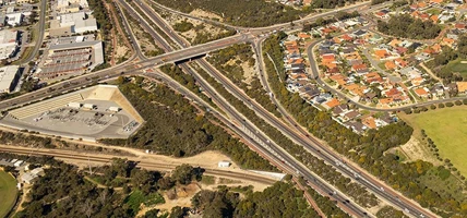
This map shows an aerial view of the project location.

Active travel options

Detour options

  • Mitchell Freeway Night-Time Lane Closures - Until December 2024

    Ongoing nightworks required at various locations along the Mitchell Freeway southbound to install Intelligent Transport Systems assets and test gantry signs. Night-time left-hand lane closures between 10pm - 4am. See Main Roads Travel Map for the most up-to-date information here.

News and project updates

See all news
See all news

Plan your journey

Avoid disruptions to your journey and plan your trip